
1/18/12 Trip Report from Colby D. and Crew Snow Pit Study Equals No Go
Wanted to share this trip report from reader Colby D.:
On our way out we stopped at the BCA park n did some practice digs. We saw Paul there and said he made it out to East Vail earlier but decided to come back (red flag 1). Decided to go anyway. Once we started to go through the windloaded areas I jumped off the track to give it a feel. I felt the snow dropping with every step and in my tracks you could see almost 2 inch air pockets on both sides (red flag 2). So we quick dug a pit. Again I am not a pro and didn’t have a saw so it was a janky pit but it had all the signs saying don’t go. the top footish in the first pit didn’t even hold up and make it to a compression test, second one did but fractured on the first hit from the wrist. that alone was enough to convince us not to go but then we noticed bellow where we had stepped of our splits there were fracture marks to (red flag 3). This on top of the fact there had been slide action in the area, we hit a few fun turns through mushy trees where the snow was heavy but had no problems.

Had a single binocular which was super cool to look at the snow crystals with

you can see the soft sugar snow under the hard layer half way up then the top is windloaded, also some punch tests
 First column attempt, we didn’t have a saw so we cut it as clean as we could but it fractured before even the first set of compression tests.

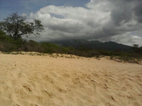
Since we decided against east vail yesterday from the top we decided to hike a run we do fairly often with the dogs. I think people refer to it as half chute. regardless we were gonna hike up through the woods as we have an established boot pack and you’re never in any high risk areas. It was a rugged hike and it seemed wicked warm today. the snow was super sticky and heavy. Once we got to the top the snow had gotten lighter so we decided to dig around and check the snow out. We had already broken the top zone into mellow sluff slides in the trees on two prior occasions so we were wondering if it was much different than the area we dug yesterday.

the pups loving the deep snow

As we started clearing out the area there was a small fracture.

I increased the contrast on this shot and you can easily see the different layers, harder on top, softer underneath. Shitty but we came to this area because there is little consequence with the crappy pack.

Kinda tough to tell what;s going on here but the bottom block slide of the sugar pile above it on the 7th wrist compression. Further proving the consequential areas of east vail could leave you having a real bad day.
 Brian and Goomba getting read to drop. The snow was super heavy, but it was fun and a good workout.
Thanks to Colby and his crew for the report and pics. We appreciate it andalways welcome outside content and comments-EVI
Mushroom bowls 12/27-12/28
With the holiday crowds closing in, I skinned my way up to Mushie two days in a row to check out the snow on both the West and North aspects in the gladed 20-30 degree terrain for something to do. The ridge top had variable areas of 10 cm wind board on facets to soft wind blown crust over, you geussed it, more facets, to dirt patches. The first five upper low angle turns off the ridgeline were decent, fresh turns on stale cake. As the pitches steepened and rolled toward the cliff band that runs in the middle of Mushroom Bowl, the skiing turned to a barely covered nightmare of no more than 60 cms of 2mm facets on rocks and fallen trees. The best way to describe a weighted ski turn two thirds of the way down is hitting a sandcastle with a baseball bat. The snow looses cohesion, disintegrates under the weight and the facets run to the dirt in a glittering hiss below the turn. A frightening prospect for a basal layer for our snow pack when (think positive) our weather cycle does turn back to snow.

If we continue to get small amounts of snow with long periods of calm weather in between, then avalanche wise it’s really no problem, it will just be a low tide year for the central mountains like most of AK’s mountains had last year. However, if we do see an averaging out of the snowfall amounts in the last two thirds of the season, then I have to imagine we will have a signifigant avalanche cycle with the first large dump. With the depth of snow in EV ranging from dirt to sixty cm of loose facets that on both West and North aspects, a two foot dump would rip to the ground with little effort with any kind of rapid loading of typical cold low density mid-winter snow on such a weakly bonded base layer. Our best hope is precip to come in warm and wet and alot of it. Or a storm comes in with such rapid loading that EV flushes itself out naturally overnight and cleans out what has become a forgettable early season mess on all aspects.
Something else to check out. Noaa has an interesting report on their website on the effect La Nina will have on Colorado weather for the rest of the winter. Much of it is super technical, but it is interesting to read the atmospheric science based precipitation predictions for the next six months. I won’t ruin it for you, check it out and draw your own conclusions.
It was a relief to get out into Mushie and skin far far away from the madnesss happening with the holidays in Vail. Just passing Two Elk helped my personal holiday decompression. The lack of sno, however trying, fails to make the skin up to the top of Benchie any less beautiful. The black, grey and white spattered Gore range, gaunt and bare, stretched into a sky littered with purple and grey clouds streaming in from the Northwest. A few tendrils of snow stretched down to touch the very tops of the Gore Range, but the wisps were wishful thinking for a range that is now feet away from average. I enjoyed standing on the top of Benchie again, wind howling and no one around. Pretty much ski hiked the last two thirds of the run both days to the road, but I enjoyed the taste of the EV experience that I have, admittedly, taken for granted over the last fourteen years.
Old Man’s 11/7/11
Hey all,
Headed out into the bluebird Wendsday afternoon, eager to escape the groomed confines of early season Vail. I decided to head to the emptiness of EV. I skinned up Sourdough and headed past Two Elk, where the workers were just starting to pull out the picnic tables from the stacks. The back was empty and parts of the West Wall sat pasted an early season brown and white. Up the Silk Road I went and headed out the back door route to Old Mans’. It was nice to get out and stand on top of the ridge and take in the expanse of EV once again, though it looked vastly different than the last time I stood on the ridge. The prominent cliff band off the right side Old Mans’ entrance, which disappeared some time in January last year, was in full view now. At present it lies just below the ridge crest, but after a half season of regular snow load, the cliff band is at least thirty to forty feet below the entrance. The growth of the scarp above the cliff band is a true testement to the amount of snow transport that occurs at this spot due to the prevailing Westerly winds. Rocky tiers, cliffs and shrubs belie what was a smooth, fast entrance crowned by a massive cornice eight months ago.
I picked my way through the entrance and dove between rocky ledges and shrubbery, taking time to cut various pillowed pockets between rockbands. These small wind drifted areas provide good test spots for stability. There was little reactivity, and the old settled storm snow sitting on the usual layer of larger loose “October” facets skied like two feet of baking soda feeling unconsolidated and, of course, thin.
I skied cautiously to the flats and headed out to the highway instead of braving the thin cross cut over to the bus stop. I linked super slow pow turns in the trees on my way down, working my way past the half buried stumps and downed trees toward the highway. More snow than I thought, but two feet away from glory… Paitence friends and think snow.

11/30/2011 Uniquely Uneva
Still in the midst of the waiting game, Wednesday November, 30th was the perfect opportunity to dust the cob webs off the ‘ol Avi gear and put the “Avalanche Thinking Hat” back on to go poke around in the Vail Pass Backcountry.

The week was full of sunshine and moderate temps that kept the somewhat minimal “snow pack” at a danger scale of Low or Level-1 on NW-S aspects below treeline up to the peaks. Aspects near and above treeline facing N-SE were rated as Moderate, or Level 2. Wednesday afternoon was a true bluebird day, mid thirties on the mercury, 34% humidity and 5-10 mph winds out of the west at 10,600 ft. All signs pointed to Uneva as a first good “tour” of the season, with relatively safe conditions and a chance to hunt down some ski-able powder.

Starting out at the Vail Pass Winter Rec Area, sets of perfect powder turns were already visible up on the SW facing aspect of the drainage just South of the Uneva bowl. A well established skin track already set on Corral Creek Trail made it very nice not to have to break trail, but here and there to keep in tune with “Avi-Thinking”, it’s really important to me to get out of the grooves and break some trail of my own, to gather info and tune into the signals and Red-Flag warnings the ascending trek and snow pack can scream or whisper at me… i.e; whoomphing, collapsing, cracking and sinking up to the top boot buckles. Not to mention poking into the snow pack to gather data on depth and what kinds of hazards are lurking under the deceiving white surface of snow. There are still some buried roots/downed logs, “Shark Fins” (buried rocks) just waiting for an unsuspecting rider to viciously end their season early… Right now the data is a mixed bag of sun drenched areas with zero snow up to two and a half foot deep drifts and everything in between, so be very careful on the way down!

Each step of the trek through the old fire-scarred area just South of Uneva up into the 30 degree sloped gully produced incredible views that improved with each lunge upward. Soon, treeline was well below and Panoramic views of the Ten-Mile and Sawatch Ranges started to peak out in all directions. The ridge-top was so scoured by 20-30 mph wind gusts that boot packing was the only remaining option of ascent. As I traversed north to the ridge-line that lay south of Uneva Peak, it was obvious that the prevailing west winds have been working hard to load the easterly aspects with as much faceted snow as possible. This wind loading is burying the “White Dragons” of the past record-breaking 2010-2011 winter season and hiding potentially very deadly scenarios for our upcoming season. Just stick that under your Avy-Savy-Hats and save it for later on this winter…

There was the first “Red-Flag” of the Tour! The Next was a 40-60 meter long crack that had shot up-slope from where a bunch of dog tracks danced in circles out on the wind loaded cornice. The crack measured a fist and a half to two fists wide creating a semi-truck wide cornice that would have no doubt given that pooch a First-Class ride to a summit county demise on the east side of the ridge. The third and final “Red-Flag’ of the day was my misstep from the scoured solid earth of the ridge into a thigh deep hole just short of the previously mentioned cornice. What a way to emphasize the oldest Avi-Traveling rule in the book… never walk out onto a cornice! That sixty pound dog was lucky, just another 100 lbs. and a few more of those deep steps out onto no-no-land and you’ve got the human factor that so famously causes deadly avalanches.

With all the data and info fresh in my head, “Red-Flags” resonating their priceless messages and the final ascent to the 12,522ft peak that is Uneva, I took the time to sit down and reflect on my journey to the summit. All of the little details and warnings add up to one of the most important decisions of the tour; how and where to descend. I opted for the SW facing shoulder of Uneva north of the Cirque, stuck to the 30 degree and fewer pitches and stayed clear of the rock features that create the chutes. Half traversing, half dropping into steeper zones, navigating the terrain was a mix of sun baked crust, facet filled depressions and full-on powder near and below treeline. Sticking to the shaded sides of the trees and the uphill side of the drainage that flows out of the Uneva Basin, I quickly descended to the natural downhill ramp that leads back to corral creak trail, the car, safety, a hot meal, and not to mention cold beers with good friends.

Not a bad first tour of the season! Being able to take advantage of the chance to dust off the Avi-thinking dust and cobwebs, the opportunity to snap shots of the surrounding mountains and scenery are what makes living and riding in the Vail Valley backcountry so rewarding and enjoyable!
Sunset Over EV

Taken from Uneva Peak, this shot was submitted from one of our FB friends Lucas. Thanks! A beautiful view and with December coming, we’re staying positive for snow!
Weather Forecast

Coming at ya! Absolutely pouring down rain here in Tacoma, WA. Should be coming your way in Colorado over the next few days. Something you all should know about me, pretty much whenever I fly into Denver or drive back up from the airport…there is a huge snow storm. Last time I can remember, we were in the last car over Vail pass for the night and really shouldn’t have been allowed to proceed. Couldn’t see a damn thing! The next morning was 13in. of light and fluffy pow with the city of Denver trapped on the other side of the pass in summit county for the whole morning. So, the answer is yes, I will start accepting payment if you are fiendin’ for some powder and want me to fly somewhere.
11/2/2011 Surface Hoar

Next storm rolled through, dumped a few coveted inches on top of our much maligned basal layer. Came in warm, started as rain and cooled off as the night progressed. Nice to wake up to the first day of work at Troy’s Ski Shop to snow. Doesn’t seem right when you’re mounting skis in warm sixty degree weather. In keeping with the last post, I wanted to address another lurking hazard prevalent in(on) early season snow pack, surface hoar. As I was riding to East Vail before this last snow, I noticed the fern like crystals stacked up on the snow next to the bike path. Clear, cold skies and high humidity are ideal conditions to produce these feathery crystals that lie vertically on top the snow.

Strong in load, but not in shear, these crystals can support subsequent snowfalls until critical stress on the fragile slab is triggered by you, intrepid backcountry traveler. Surface hoar is hard to keep track of. It can be destroyed by wind in some areas while persisting in others. Even by digging a pit in the locale that you want to ski, it is hard to determine if buried surface hoar is still present in the entirety of the area you are going to put a load onto by riding. Next time a cold clear night happens with little wind, check around the next day to see if those crystals are around and file it into your never-ending assessment of the growing snowpack around you.
Ride to the Sun EVI Training Final Exam
Five thirty in the morning and I’m headed in the darkness to the small town of Paia on Maui’s west side, across from the legendary windsurfing mecca of Ho’okipa beach. The Fuji road bike is assembled and ready for the ride that starts here, climbs up country through the ranch towns of Makowao and Kula and into Haaleakela park. I plug in the headphones and I’m off, go team!

Mile One
I feel good. I break throught the first twenty minutes and get into a rhythm, slowly leaving the ocean behind. My support vehicle, Ryan on his Honda Rebel, has decided to tag along for the entire journey. The sun comes up over the east side of the island and I catch a glimpse of the incedible sunrise. Up country Maui is a world unto itself, far from the beaches and tourists, it is a land of cattle, cowboys and sheep ranchers tucked underneath the shadow of the volcano I’m about to climb. Glimpses of unparalleled beauty here, flowering vines entwined in barbed wire, sheepdogs chasing their flock through rolling grasslands, estates with flawless Japanese gardens roll past.

Mile 15
An hour has taken me through the two towns and I stand at the Haleaakela park sign, my first break. The approach is done and now the true climb begins. I try not to think about the twenty two miles left. I still feel strong but the first fifteen miles has me sweating and legs feeling it. Time for the mental games to begin, trying to take chunks out of the miles by aiming for smaller goals, the next sign, the next switch back. Fueling and drinking as much as i can, I begin the endless parade of switchbacks up the flanks of the volcano. There are markers on the pavement for bikers like myself, indicating the elevation and giving instructions when to eat and drink. Ryan putters by me and waits every half mile to give me a towel as I am drenched in sweat 2500′ feet and climbing…

Mile 20
At 5000′ the road breaks out from the lowland trees and ranchlands and into the steep grasslands, two of the four unique climates that I will go through. Here the switchbacks tighten and my first real battle against fatuige begins. Altitude hits me and I’m sure I’m dehydrated even though I’m drinking as much as possible. My speed slows and I have to take a break, surprised at the effect of the altitude. I’ve already eclipsed my max vertical for a single bike ride and the road is relentless, up up up. Ryans’ cheerful exclamation “only seventeen miles to go!” are welcome but his voice seems farther and farther away. The view are stunning and surreal, looking down on the beaches and towns, but there is work to be done seventeen miles to go and another 5000′ feet of climbing. The bike is too small and brain is starting to find reasons not to do anymore of this silliness, but I push upward until the switchbacks mellow just a bit, savoring every extended section of road that doesn’t have a hairpin turn in it. A parade of rental cars passes me up and down, occasionally a fist pump out the window or a incredulous look. Allez allez allez.
Mile 25
Passed the lower ranger station stopped on the grassy lawn and spawled out for a bit, staring into the sky and wordering how the hell I’m gonna get up the last 2500′ vertical. I can’t seem to eat enough mini snickers or drink enough water. Up above the clouds soar up and over the rim of the volcano. The summit crater looks tantelizingly close but still 12 miles away. At 8000′ the clouds roil and churn. The land is shifting into a beautiful but barren moonscape, lava and sparse plants, reminiscent of the terra high up on a fourteener. I hunch down over bars, and deperatley try to find the mental zone where the pain fades, jabbering mind quiets and all that exists is the white line you are following and the sound of your own breathing. Final push, here we go.

Mile 30
I’m talking to dead relatives now. There is no escape from the sheer exertion I have put out and my mind is rebelling and legs are screaming. I cycle through happy thoughts to get just one more peddle. Cheeseburgers, milkshakes, powder skiing all are temporary cures for the pain. I crawl upward through the clouds whipping over the summit and down into the lee side of the volcano. The tempeature has cooled and the breeze is welcome. Trying to figure out how I can lash my bike to Ryan’s motorcycle for the rest of the way. At 9000′ up, the only option is to finish this ride so I don’t have to come back and do it again. I hate my bike with a absurd ferocity at this point. I feel like a bear at the circus riding the little bike around the ring. Get me off this thing.
Mile 37
Hit the wall harder than I ever had in my life. Staggered into the visitors center and collapsed on the first bench I could find, curled up in a fetal position and passed out for a half hour. Nothing left at all. I’ve never been so tired in my life, unable to sit up for twenty minutes. Voices fade in and out, Ryans, tourists. Like any big mountain climb getting up is only half the battle, I have no clue how I’m gonna get down. I feel like dog poo. Sat up finally and realized that the summit was another five hundred feet up another half mile. I look at Ryan and shake my head. He laughs and nods, knowing I have to finish the ride. A nice lady from Breckenridge stops and lets me know she saw me on the way up. I remember her, she mouthed the words your crazy as she went by. She gives me two bannanas and wishes me luck. Force myself to stand up and wander around the visitors center and listen to the ranger talk. The crater is so big that manhattan could fit inside it, growing two inches a year away from the lava source. It is amazing and barren, a place not to be lost in.

Summit
I recover amazingly fast. The bannanas help and my body seems to adjust to the altitude pretty quickly. Compared to how bad I felt just a little while ago it is night and day. I break no land speed records for the last half mile to the actual summit but I make it. The clouds break and we get great views of the Big Island’s 13000′ foot volcano. Ryan and I get the obligitory photos up top and turn around for the descent. All downhill now. It is done. Kind of like hitting mushroom rock in EV. Glad I did it, more glad I never have to do it again, but what a challenge. I push off for the downhill and the miles clip past, somewhere in the middle of the descent I start laughing like Stewie from Family Guy and name my bike Silky for its superoirty on the downhill(I’m still a tad loopy) Only one scary moment coming down. I hit a hairpin too fast, laid on the breaks and Tokyo drifted towards the opposite gaurdrail. I stop, reassess and proceed with a little extra caution toward the beaches and towns where I belong. I give myself a passing grade, maybe not an A but sometimes passing is enough…Aloha
EVI warm weather training Maui
We are coming down to the wire with the training as the slide toward ski seson nears its finish. To me it’s the most impatient time of year, waiting for the first big storm to erase the six months of off season. I know that the lifts are open at certain areas, but I’m not one to hit the strip of death. Hopped up college kids and eager early seasoners looking to drive you into the trees isnt what skiing is to me. Don’t get me wrong the passion I respect, the chance of injury I don’t want to deal with. Do I sound like a jaded local? I am, admittedly. I’ve paid enough insane rent and nine percent sales tax over the years to qualify. If you do go be careful, watch your nine and six o clock and I’ll see you all at the end of the month.
So what to do now? Keep training and choose somewhere warm to finish the wait if you can. As important as the physical training is, mental preperation for the seven months of skiing is equally important. Even the most die hard skiers know its a long winter, and stocking up with some memories of warm sand and lapping ocean is a good idea.
I’ve been in Maui for a week now, and my brain is saturated with perfect beach sights, beatiful girls and turquoise ocean, but now I’m restless. I can feel the pull of the season and I catch myself looking out into the ocean at the far away storms and wonder if its headed for our neck of the woods. At 39, I’m still as captivated by the cycle of the winter season as I was fifteen years ago.
Inspired by the xterra race hitting here on sun I’ve decided to put the EVI training to the test. Looming over the island of Maui is the immense volcano of Haaleakela, rising from the ocean to 10000 feet above sea level. It has been called one of the most grueling bike rides in the world. And dammit I’m gonna do(try) it. The acid test of the EVI training school.
Let’s make something clear. I’m not a road biker. I don’t shave my legs, my forearm are larger than toothpicks and I don’t own any Postal Service jerseys or spandex shorts. But sitting outside my door is a carbon fiber steed that I rented today and its waiting for me for tommorow at five am. Can a gorrila on a bicycle get up the Maui monolith? I don’t know. I do know what I’ll be thinking of to put the miles, the screaming legs and the cars of gawking tourists and the heat behind me. Three feet of blower in EV on a Tuesday morning….Aloha
Snow over Vail pass
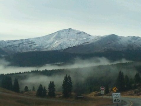
Caught this early this morning on my way over to summit county…could be a good year.
